Sites
- Fjellheisen launches
- Mandelasletta ("Mandela")
- "TIRB"
- Fløya
- If you cannot reach one of the landing sites
- Finnvikdalen
Fjellheisen launches
Our two main Fjellheisen launches are indicated on the map below.
The main risk when flying from Fjellheisen is possible sea breeze, especially in summer, often in the afternoon or evening. The mechanism is the same as valley winds in the mountains and you should treat it with the same respect. If you see white caps on the water, if the water surface looks choppy and dark, don't fly! You can have perfect start wind at the launch or even wind still, but a sea breeze can surprise you during the last 100 - 150 meters before landing and you might need to land backwards on speed bar in a weird place.
If you are already in the air and see that wind is picking up, it can be safer to top-land on the plateau rather than trying to land at sea level.
Mandelasletta ("Mandela")
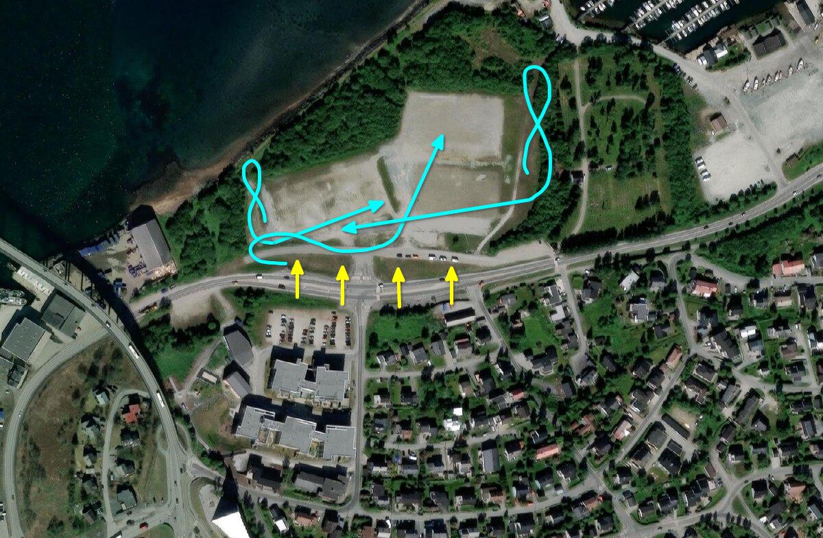
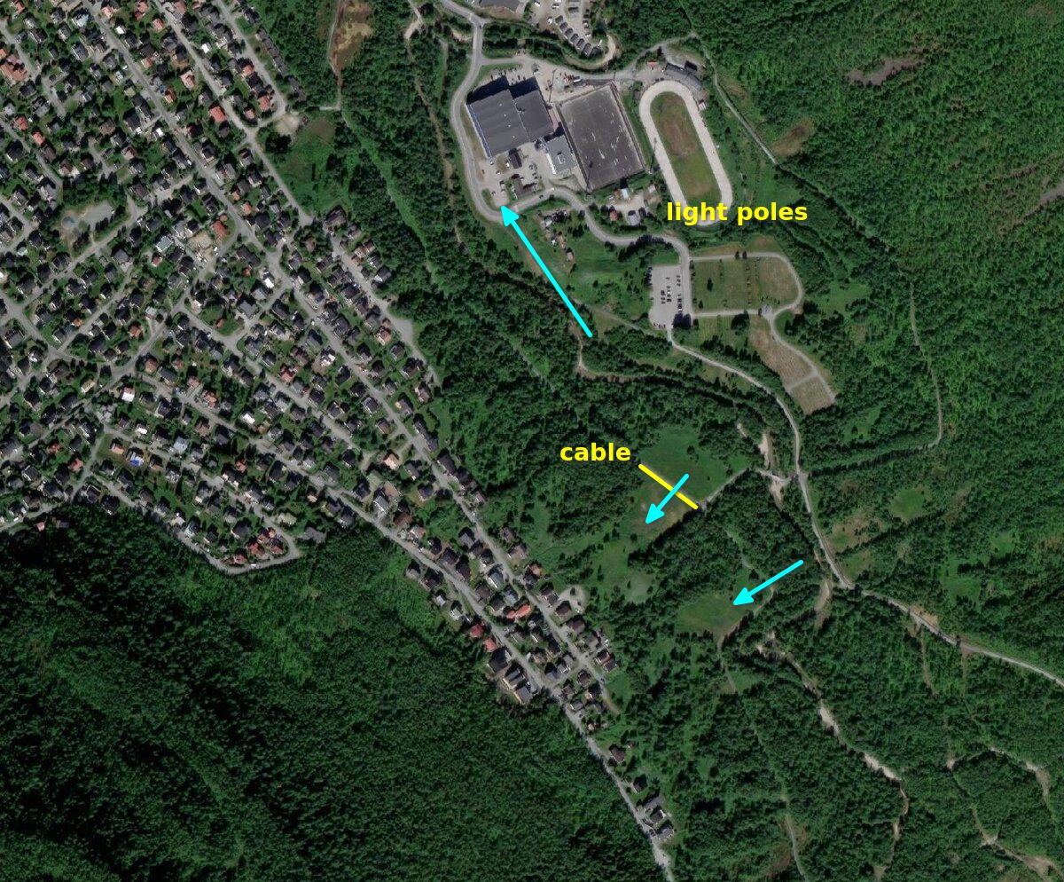
Mandela is our main landing site. We use it also during courses. It is huge and typical approaches are indicated in the image below.
Risks:
- Sea breeze
- Light posts
- Wind gradient
- Circus/fair/camping/festival/dogs
- Convergence over the valley and very bumpy air (rare)
"TIRB"
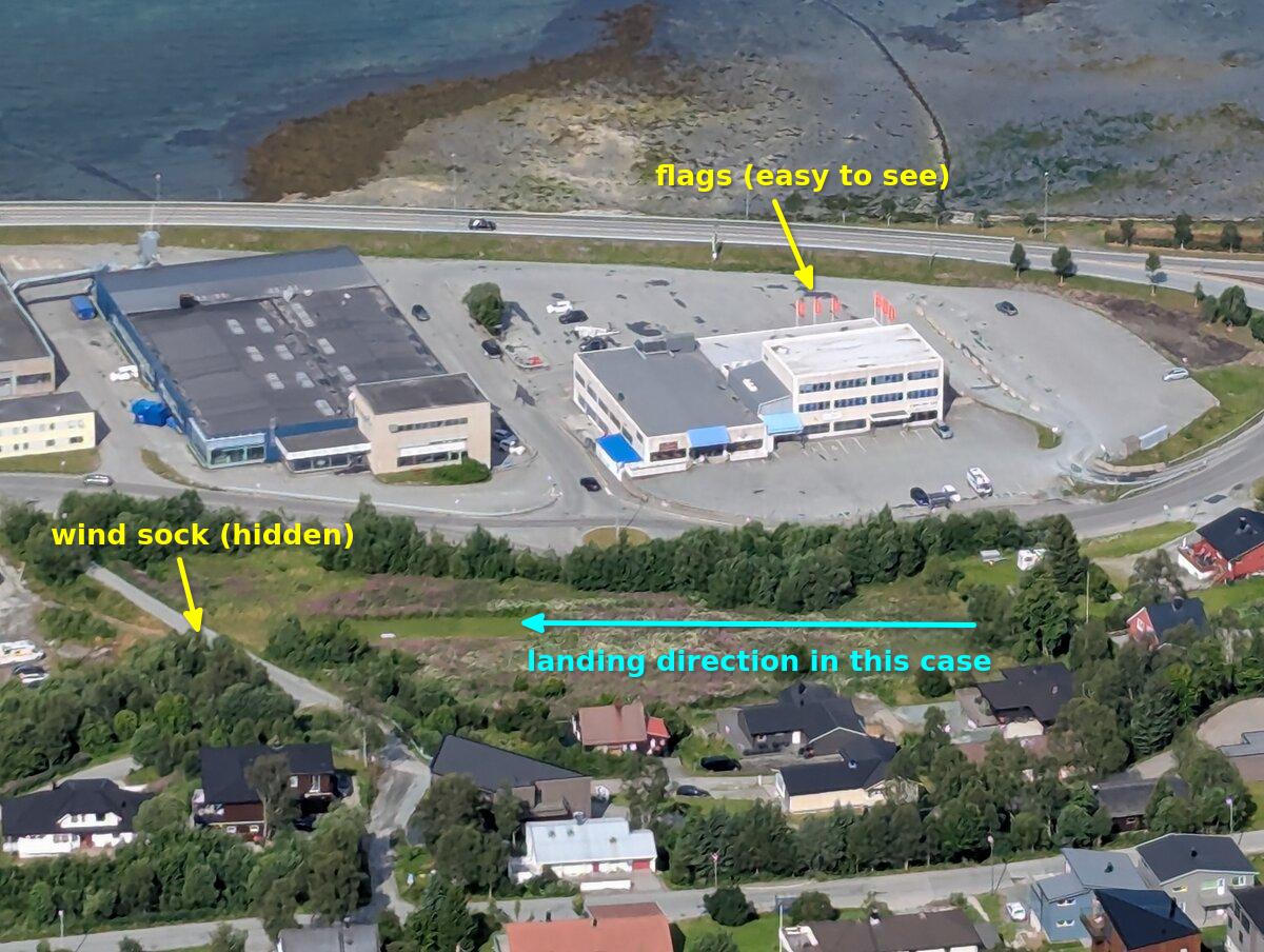
TIRB is our second landing site. It will unfortunately probably disappear in 2026 and be replaced by apartment buildings so please check it visually before you fly.
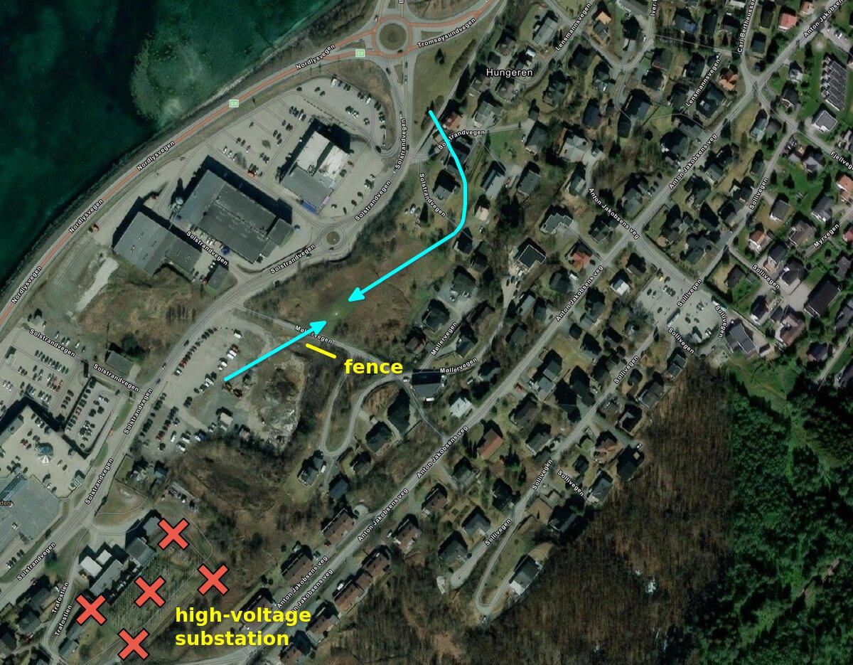
The two typical approaches are indicated in the image below. If it is wind-still or almost wind-still, approach from the south as it feels a bit easier than from the north. Use the orange flags on top of the supermarket as indicator for wind direction.
Risks:
- Sea breeze
- Can be turbulent, especially on stronger westerly winds
- Fence next to the wind sock
- There can be traffic and people on the path next to the landing
- Don't ever even fly over the high-voltage substation ("toaster")
Fløya
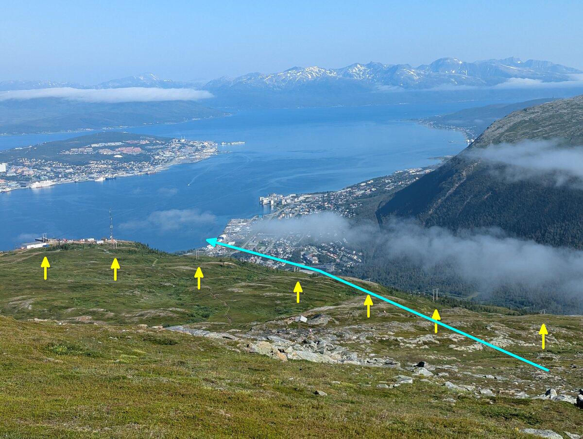
Typical launches and flight paths:
- It is possible to launch towards almost any direction except on stronger easterly wind
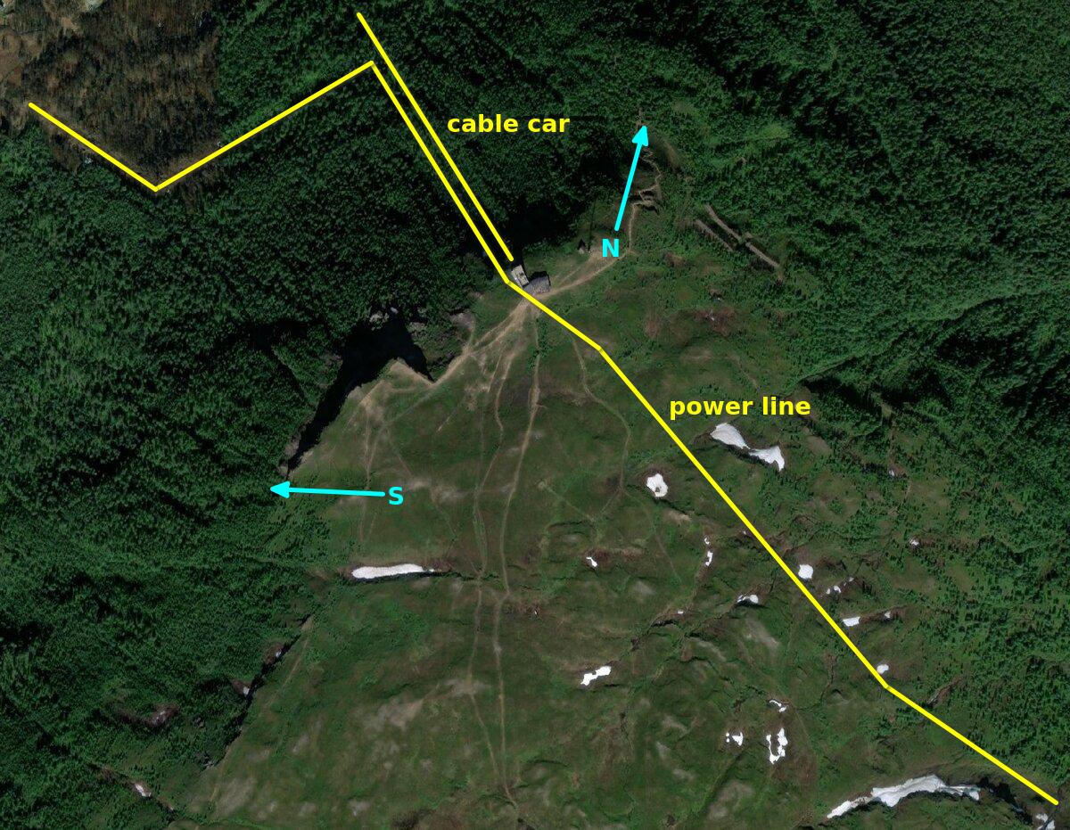
- Typical flight paths are overflying S start on S/SE wind or to fly around the antenna next to N start on N/NE wind
Risks:
- Since the launch is slightly above 2000 feet, do not soar or thermal right above launch so that you don't break the typical 2000 feet limit
- Power lines towards north
- Somebody closes the box while you launch or are in the air because they cannot see you from TIRB ⟶ always give a 15 minute warning before closing Fløya box
If you cannot reach one of the landing sites
Mandela or TIRB are almost always reachable. But it is good to know that alternatives exist for emergency situations. They are indicated in the image below.
Finnvikdalen
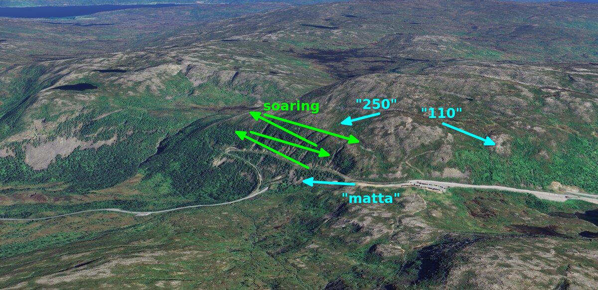
Typical launches (see image below):
- Matta
- 250 (because it is 250 meters above landing)
- 110 (because it is 110 meters above landing; we only use this in winter when we can soar on SE wind and land on top of the frozen lake)
Landings:
- Huge swampy area at the bottom of the valley
- The parking ("top-landing")
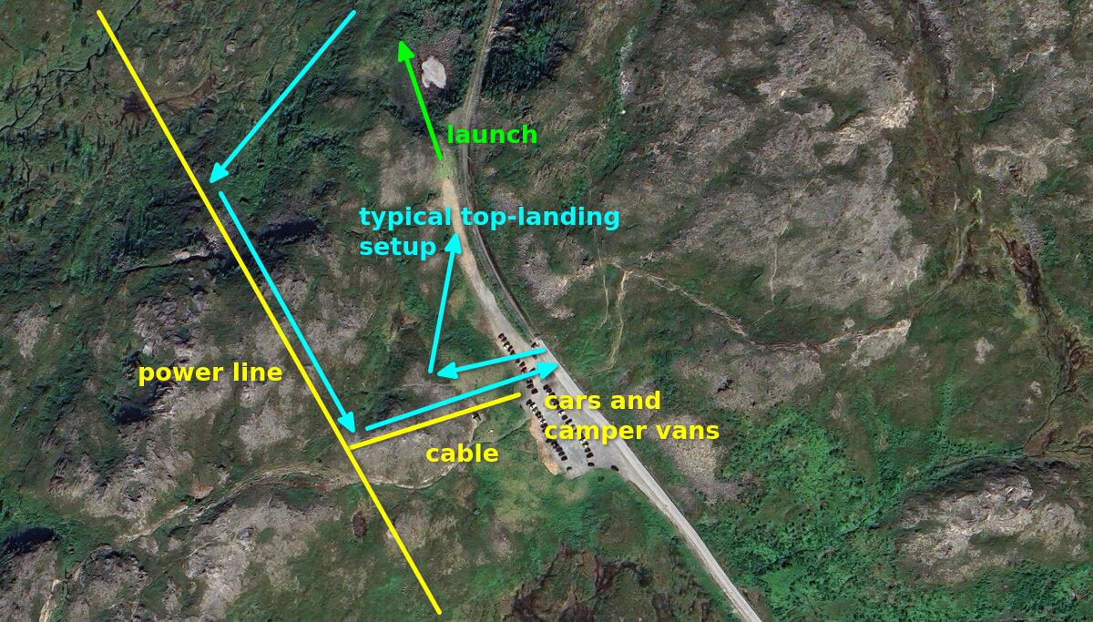
Please also see the image for a typical soaring setup in Finnvikdalen:
Risks:
- Cables and power lines
- Wind picking up ⟶ land in the valley
- Cars and tourists at the parking obstructing a possible top-landing
- Too much focus on "stuffing" the top-landing at first attempt ⟶ fly out, soar up, and try again with a better setup
- Model planes or drones
- Flying too far back behind the soaring slope and getting blown back there
